VS Roads and VS Terrain
BikeSim, CarSim, and TruckSim include multibody models that simulate vehicle dynamics under driver/rider control on a 3D ground surface. This 3D surface is a major part of the environment in which the vehicles operate.
VS Road Model
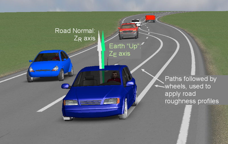
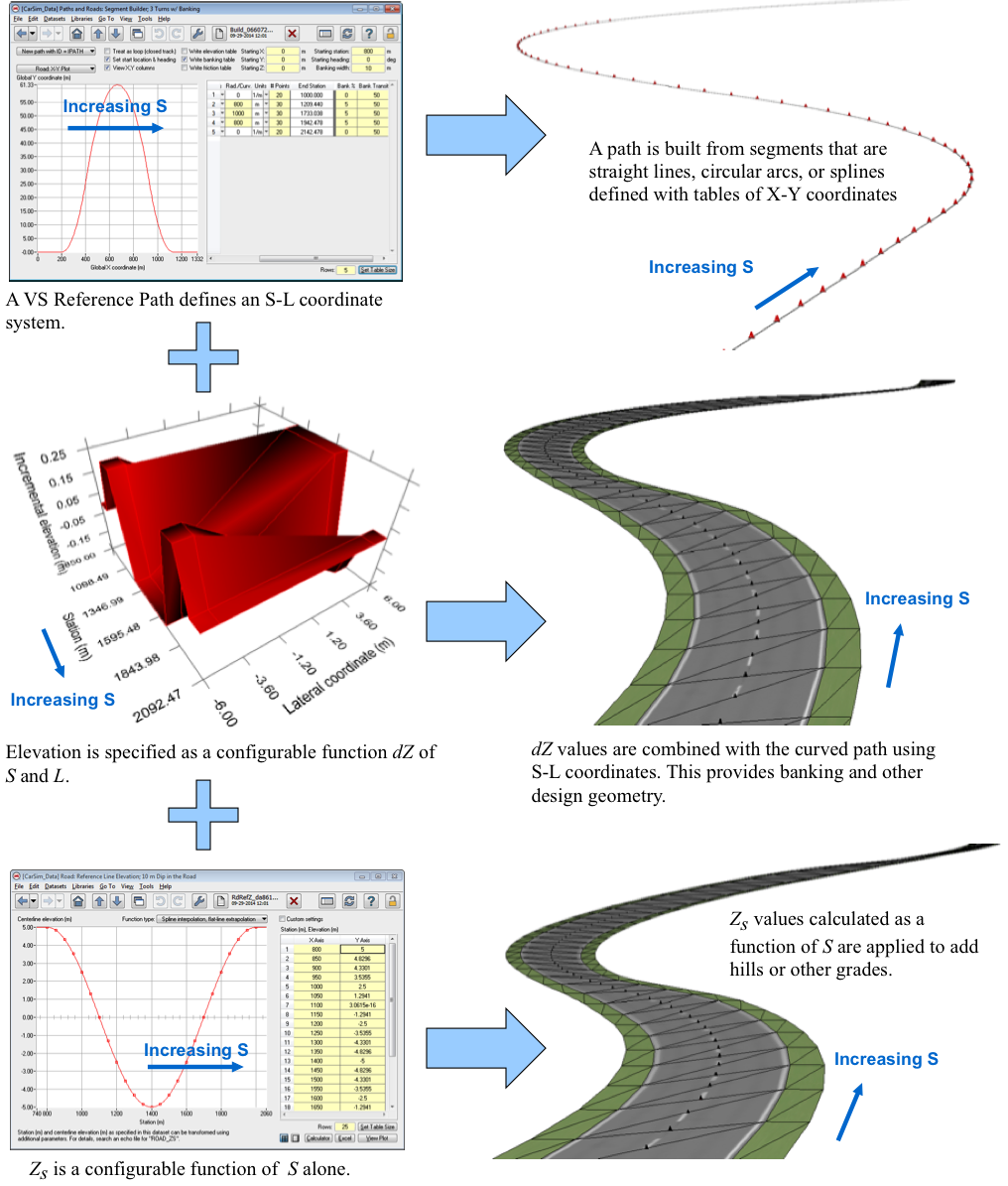
The VS road model defines elevation geometry and friction using S-L coordinates associated with a VS Reference Path. This allows detailed information to be concentrated in the region of interest (i.e., on or near the road path).
The 3D surface is defined as a collection of up to 200 road surfaces, where each road surface is in turn defined using a 2D VS Reference Path.
Properties of each surface are defined with Configurable Functions of S and L. These include friction, rolling resistance, and relative elevation.
Connections between adjacent surfaces can be specified to allow the simulation to automatically move points from the moving bodies between surfaces automatically.
The VS Browser uses the road datasets to automatically generate animator shapes to allow visualization of the ground geometry in animations.
VS Terrain
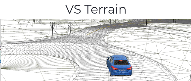
The VS Terrain is an alternate method to provide a terrain representation to the math models. It uses a single 3D mesh to represent the ground using global X-Y-Z coordinates, and stores the data in a binary file with extension .vsterrain.
This format exists as a means to make use of 3D ground data from other sources in VS Solvers. Two methods are used to generate .vsterrain files:
Use VS Scene Builder to assemble a 3D scene, and connect it to a simulation using the Scene: External Import screen. The scene will include a .vsterrain file for 3D ground geometry.
Use the VS Terrain Utility (accessed from the Tools menu) to convert an existing .fbx file to .vsterrain format. (FBX file can be made by most 3D modeling tools.)
Road Roughness
Roughness profiles allow realistic road roughness inputs to be used in simulated tests without requiring the extensive amounts of data needed to fully map a 3D surface, especially in cases where the vehicle is not following a straight path. These can make use of data routinely measured by highways agencies, or generated with suitably filtered noise from random number generators.
A "wandering profile" is defined as an increment of elevation Z defined as a function of distance travelled, where the distance travelled is calculated in the math model by integrating the forward speed for the front wheels, and adding the distance between axles to get the proper delay of inputs for other axles. CarSim and TruckSim models include two wandering profiles; BikeSim includes one.
Video Tutorials
VehicleSim Products
CarSimTruckSim
BikeSim
SuspensionSim
Built-In Features
ADAS: Moving Objects and SensorsAnimation and Plotting
Automation and COM
Built-In Controllers
GUI, Database, and Documentation
Modular VS Math Models
Paths and S-L Coordinates
Roads and Terrain
VS Commands Language
VS Scene Builder Tool
Co-Simulation Technologies
Real-Time HIL SupportSimulink, FMI/FMU, LabVIEW
Unreal Engine
VehicleSim SDK
More
Engineering Services